Follow us

Winter hike to the Alpenrosenhütte

Westendorf

Winter hike to the Alpenrosenhütte

  • Starting point: valley station Alpenrosenbahn
  • Route: Valley station Alpenrosenbahn - Hollern descent - Ellmerer - Forest piste 110a - Trattberg - Alpenrosenhütte

Route description

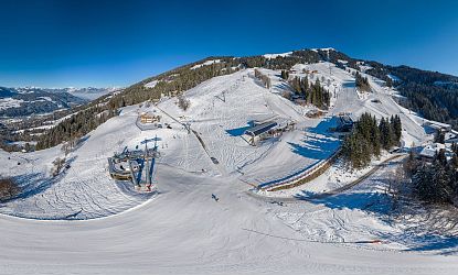
You start at the Alpenrosenbahn car park and first walk along the Hollern downhill run. Then turn off towards WestAlp and cross the road above Kälberpoint. Continue across a meadow in the direction of Ellmerer.

You circle the Ellmerer farms and climb up the slope above the farms to the edge of the forest. Then follow the hiking trail through the forest for a while. At the first clearing, keep left on the tractor track until you reach a piste. Cross piste 110a, then take the tractor track up to the Trattberg and on to the Alpenrosenhütte.

-> Take the Alpenrosenbahn cable car down from the middle station.

Attention

Use of the signposted ascent track is only permitted during the operating hours of the mountain lifts. Ascending outside the signposted ascent track is prohibited and endangers both skiers and ski tourers. Dogs are generally prohibited on all pistes.

Gondola

There are 2 ticket options available so that you as a winter hiker can use mountain lifts in winter. Either you buy individual tickets for each lift OR you use the multi-day winter hiking pass, which is valid for all pedestrian lifts in winter in the SkiWelt Wilder Kaiser - Brixental.

Ticket options

  • Single tickets – valid for individual lifts (only available on site, not sold online)
  • Winter Walker`s Pass – valid for 13 mountain railways in the SkiWelt Wilder Kaiser – Brixental (3–6 days, only available on site, not sold online)

Cabins

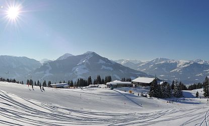
Verschneite Winterlandschaft mit Pisten, Berghütten, Skifahrern und strahlender Sonne über dem Skigebiet Wilder Kaiser – Brixental
Brixen | 5,2 km | 2 hours
Hochbrixen- Winter hiking trail
You start your hike at the valley station of the Hochbrixen gondola. From there, you head up the mountain behind the lift building in the direction of the “Berggasthof Nieding”. After passing the inn, continue along the mountain road to the Hochbrixen top station or the Zinsbergbahn valley station...
Panorambild der Winterlanschaft mit klar blauem Himmel.
Ellmau | 1.5 km | 30 Min.
Ellmi's winter loop trail
At the Hartkaiserbahn mountain station, you set off on the circular hiking trail through the snow-covered "Ellmi's Magic World" and hike through the enchanted forest. The path leads you back to your starting point...
Hopfgarten | 1h. 15 min.
Salvenbahn to the valley Winter hiking trail
The winter hike in Hopfgarten begins with the ascent with the Salvenbahn I in Hopfgarten. Get off at the middle station and head right back down into the valley to the Salvenbahn valley station in Hopfgarten...
Panoramafoto der Mittelstation Salvenbahn zur Salvenalm oder Tenner Stadl in Hopfgarten
Hopfgarten | 0.7 km | 30 minutes
Salvenbahn-Salvenalm winter hiking trail
The winter hike in Hopfgarten begins with the ascent with the Salvenbahn I in Hopfgarten. Get off at the middle station and make your way up to the Salvenalm. The Salvenalm (and also the Tenner Stadl) are located directly on piste 21/22 and are therefore an ideal meeting point for hikers and skiers...
Zwei Winterwanderer die von der Brandstadl Bergstation zum Brandstadlkreuz in Scheffau wandern.
Scheffau | 30 Min. | 40 hm
Brandstadl summit cross - winter trail
The winter hike to the Brandstadl summit begins with the ascent on the Brandstadlbahn or Brandstadl gondola lifts. From the mountain station, turn right onto the path next to the piste to the Brandstadl cross...
Winterlandschaft mit Wohnhäusern.
Söll | 30 Min | 20 hm
Gasthof Salvenmoos Winterwanderweg
From the top station of the Hexenwasser gondola lift in Hochsöll, you hike up on the left-hand side towards Salvenberg and soon reach the Gasthof Salvenmoos. From the alpine inn there, you can watch the skiers on the Salvenmoos descent and admire the snow-covered Hohe Salve...
Die Hexen gehen mit den Kindern durch den verschneiten Winterwanderweg.
Söll | 1.5 Std. | 100 hm
Winter hiking trail Koglrunde
From the top station of the Hexenwasser gondola lift in Hochsöll, hike down to the right towards Stöcklalm. From there, take the short Mondrodelbahn or family descent and after the "AmVieh Theater" stable, turn onto the road uphill towards Hochsöll around the Salvenmooser Kogel. From Gasthof Salvenmoos, you then head back downhill to the starting point...
Ausblick auf den Wilden Kaiser.
Going | 4h 30 Min. | 360 hm
Hollenauer Kreuz winter hiking trail
From the center of Going, walk right past the parish church on the Söllnerweg towards the forest. You will pass several farms. At the Gabelhof farm, you walk a short distance downhill along the road until you have almost reached your destination at the Hollenauer Kreuz snack station. The Hollenauer Kreuz is located on the right-hand side with a breathtaking view of the Wilder Kaiser, which you can enjoy from a bench. The snack station is located directly on piste 100b. The perfect meeting point for hikers and skiers...
Zwei Winterwanderer die durch den verschneiten Wald wandern.
Going or Ellmau | 2h 45 min. | 460 hm
Hausberg winter tour
Take the Astberg chairlift up and follow the winter hiking trail on the right-hand side through the forest to the Jezz Alm. From there, hike down the road to Ellmau. Pass the church and cross Marchtstraße to return to Going.
Beschneite Hütte am Berg mit einem Alpenpanorama.
Ellmau | 6 h | 600 hm
Culinary winter tour
Start in the village centre and head towards the Hartkaiserbahn cable car. At the turn-off to the valley station, however, continue straight ahead uphill. Passing the ‘Bergdoktor-Praxis’ house , you will reach the district of Faistenbichl. There, a forest path leads off to the left to the Rübezahl-Alm hut.
Brixen | 10 m
‘Riesen-Panorama’ scenic vista point in winter
Take the Hochbrixen cable car to the top station. From there, walk 100 meters to the Zinsbergbahn cable car and take it to the top. On the roof of the Zinsbergbahn mountain station, you can enjoy the view from the "Riesen-Panorama" viewing platform...
Die Hexen gehen mit den Kindern durch den verschneiten Winterwanderweg.
Söll | 50 minutes | 70 hm
Adventure winter hiking trail Hexenwasser
The picturesque 2 km long winter hiking trail to the Stöcklalm leads across snow-covered fields and offers visitors breathtaking views of the Hohe Salve at the start of the season. Along the way, resting places with benches invite you to linger. There are natural wonders large and small to discover everywhere, such as icicles, snow flowers and fascinating plays of light. Depending on the weather, you can also admire lovingly designed snow sculptures along the way. In total, there are 100 meters of altitude to overcome.
Panorambild der Winterlanschaft mit klar blauem Himmel.
Ellmau | 1 km | 2.5 hours
Hartkaiser - Tanzbodensee winter tour
The starting point is the Hartkaiserbahn valley station. The gondola lift takes you comfortably up the Hartkaiser to the mountain station. At the top, a short circular trail leads through the forest to the photo point at the panoramic picture frame with views of the Wilder Kaiser...
Westendorf | 6 km | 2.5 hours
Cable car hike Choralpe
Your hike starts in the centre of Westendorf and first takes you through Schulgasse. From there, you continue along an idyllic meadow path to the district of Bichling. Turn left at the Schermerhof farm and pass an old bread oven, which houses a beautiful nativity scene in winter.
Westendorf | 3.2 km | 2 hours
Winter hike to the Alpenrosenhütte
You start at the Alpenrosenbahn car park and first walk a short distance along the Hollern downhill run...
Westendorf | 6.8 km | 1h 45 min.
Winter high altitude hike Choralpe
From the village centre in Westendorf, head towards the Alpenrosenbahn cable car. You pass the gondola lift, where you can also buy lift tickets, and walk straight ahead along Oberwindauer Straße. After a short ascent, you will reach the valley station of the Choralmbahn...